Introduction
The increasing frequency and intensity of wildfires have become a pressing global issue, significantly impacting air quality and public health. As these events escalate, innovative solutions are essential to manage and mitigate their effects. One such solution is the deployment of AI powered drones that are transforming the way we understand and forecast wildfire smoke patterns.
Understanding Wildfire Smoke
Wildfire smoke is a complex mixture of gases and fine particulate matter that can pose serious health risks. Exposure to this smoke can lead to respiratory issues, cardiovascular diseases, and other health complications. The Centers for Disease Control and Prevention (CDC) warns that vulnerable populations, including children and the elderly, are at the highest risk during wildfire events.
The Role of AI Powered Drones
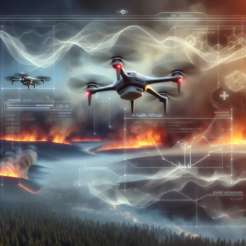
AI powered drones are equipped with advanced sensors and machine learning algorithms that allow them to map smoke patterns in real-time. By flying over affected areas, these drones collect critical data on smoke concentration, temperature, humidity, and wind patterns. This information is then processed using AI technologies to provide accurate forecasts of smoke dispersion and its potential health impacts.
How Drones Work in Mapping Smoke Patterns
- Data Collection: Drones equipped with multispectral and thermal imaging cameras gather data on smoke density and composition.
- Real-time Analysis: The data collected is sent to a cloud-based AI system for processing and analysis.
- Health Forecasting: AI algorithms assess the correlation between smoke patterns and health risks, generating forecasts that help inform the public and authorities.
Historical Context
The integration of aerial surveillance in wildfire management is not new. However, traditional methods often involved manned aircraft and ground-based observation, which are resource-intensive and limited in scope. The advent of drones and AI technology marks a significant evolution, allowing for more extensive and efficient monitoring.
Case Study: The 2020 California Wildfires
During the devastating wildfires in California in 2020, AI powered drones were deployed to monitor smoke patterns. The drones provided real-time data that was crucial for health advisories issued by local authorities. As a result, vulnerable populations were better informed and could take necessary precautions.
Benefits of AI Powered Drones in Health Forecasting
Enhanced Accuracy
AI algorithms can analyze vast amounts of data quickly, leading to more accurate smoke forecasts. This precision is vital for public health initiatives.
Timely Alerts
With real-time data collection, health alerts can be issued swiftly, allowing communities to prepare for and respond to changes in air quality.
Resource Efficiency
Drones reduce the need for manned aerial surveillance, lowering operational costs and enabling more frequent monitoring.
Challenges and Limitations
Data Privacy Concerns
The use of drones raises potential privacy issues, as they collect data from vast geographical areas, which could inadvertently capture private information.
Weather Dependencies
Drone operations can be significantly affected by adverse weather conditions, limiting their effectiveness during critical wildfire events.
Future Predictions
As technology continues to advance, the capabilities of AI powered drones are expected to improve. Future developments could include:
- Integration with IoT: Linking drones with Internet of Things (IoT) devices to enhance data collection and analysis.
- Advanced AI Models: Utilizing more sophisticated AI models that can predict health impacts with greater accuracy.
- Broader Applications: Expanding the use of drone technology to monitor other environmental hazards beyond wildfires.
Conclusion
The deployment of AI powered drones for mapping wildfire smoke patterns represents a significant advancement in public health forecasting. By providing accurate, real-time data, these drones not only enhance our understanding of smoke dispersion but also improve the ability to predict health outcomes. As technology evolves, the integration of AI in environmental monitoring will continue to play a crucial role in safeguarding public health from the impacts of wildfires.
Call to Action
Stay informed about the advancements in drone technology and how they impact our health and environment. Communities are encouraged to engage with local authorities to understand the resources available during wildfire seasons.


Leave a Comment